Monday, 15 September 2014

Migration Update #1

One week and one-thousand kilometers later, three of our tagged whales are heading west...

Now that I am back in Christchurch, my updates to Megaptera14 are going to be about once a week. Monday nights (NZ time) work best.  But I do promise to keep updating you all so long as these tags are transmitting!

For this week's update, I've prepared some graphics. Top of the order is an update on where our whales have headed (this will be the standard lead-off position in the weeks ahead as well - Figure 1 is almost always a map when you're dealing with a ball-playing geoscientist!). There are several interesting points to make about the whale movement data presented in Figure 1 (below).

First, the migrating whales are moving west/northwest along very similar paths.  This 'route fidelity' is fascinating to me as none of these whales are ever in the same place at the same time. They might very well pass over the same chunk of ocean floor (~5000m below them!), but they're doing so at different times (n.b. - the tracks symbolized by triangles are from 2007! The larger colored circles are the 2014 data.). If there is an outbound migration corridor around Rarotonga, it is most certainly to the west-northwest. This gives us strong evidence to suggest potential 'no-long-line-fishing' zones during certain months of the year - a triangle connecting Rarotonga, Niue, and Palmerston would be a great start!


Figure 1 - Humpback Whale movements near Rarotonga (mid September, 2014)


 Second, our 2014 data is much higher temporal resolution than our 2007 data. In other words, we are receiving more transmissions per day from each tag in 2014 than we did from each tag in 2007. This is GREAT PROGRESS as the temporal resolution of the data dramatically impacts the level to which we can interpret each whale's movement behaviors! More data points means we have a greater chance of capturing turns, slow-downs, speed-ups, etc. I am very excited by the temporal quality of our data this year.  Here's hoping the tags keep transmitting for several months!!

Third, I might be seeing things, but it sure looks like 112726.14 got a call from Niue yesterday and decided to stop in for a visit. 'She' should arrive in Niue late on Sept. 15 local time if she keeps following the same trajectory. Now you might think I'm really starting to see things if you believe me when I say that it looks like one of the 2007 whales did a very similar thing just before its tag dropped (medium grey triangles approaching Niue from the east-southeast). Maybe polynesians really did 'ride whales' when they were island hopping during the past millennium?

Fourth, the Distance Traveled versus Day of Year plot shows that this year's migrators are a fast bunch.  They've been swimming ~6-7 km/hr for the past week straight without stopping - day or night. Cool.

For those of you who love data (like me), I've made a couple extra plots for your viewing pleasure and metacognitive pain. Figure 2 presents a couple pie charts. The one on the left shows the relative proportions of location data received by the 6 different Argos system satellites (MA, MB, NK, NN, NP, SR). The pie chart on the right shows the relative distribution of the location data's quality (3 is the best quality, zero is the worst quality - A and B could be good or could be bad, the Argos system couldn't tell). Clearly we're getting mostly 'B' quality data. This is not ideal, but it's not necessarily bad either...


Figure 2 - early to middle September (2014) Rarotonga humpback whale satellite transmission data - by Argos satellite (left) and data quality (right)


Figure 3 shows all of the whale locations the Argos system has received as a function of hour of the day. The vertical axis is plotting the 'error radius' of the whale location as determined by the Argos system (all those 'B' quality locations have largely 1-5 km errors - which is not so bad considering the spatial scale of the migrations). The parabolic curves are plotting when each of the Argos system satellites are able to receive radio transmissions (i.e. the vertical axis for the parabolic curves is basically how high in the sky the satellite is during its passage over the region). I can't see any clear pattern relating satellite position, or satellite count, to error radius. And it looks like our chosen transmission periods don't have many holes/gaps; we deliberately pre-programmed the transmitters to save battery and shut-down when the 'NP' satellite was passing as it was the sole satellite during its passages over Oceania this time of the year.

Figure 3 - Relationship between satellite transmission data quality (as Argos error radius), time of day, and receiving satellite position.


Perhaps the BEST thing about Figure 3 is that it shows quite clearly that we're capturing both sides of dawn and dusk nicely. Crepuscular (homework = look it up!) behaviors are common in the biosphere and I quite deliberately made sure that we set up the tags to collect data across these important times of the day. I'd estimate that half our data was collected during periods of darkness and half our data was collected during periods of daylight. The possibilities indeed are endless.

And I'm curious as to whether or not last week's class 2 solar flare wrought any havoc on the navigational systems used by these whales. Another topic for another day, perhaps?

Monday, 8 September 2014

Tag count 1!

Huge progress over the past few days! The team's hard work has really paid off with four more tags successfully deployed over the past 48 hours. That brings our total to 9 tags deployed - with 8 of them having transmitted humpback whale locations to us via the Argos satellite system. Great work TEAM!

Our track data are already revealing several interesting results. One of the whales (tag 87777.14) has already started migrating away from Rarotonga...to the NORTH! This is a brand new insight into Rarotonga humpback movement behavior given that all seven of the 2007 whales headed away from Raro in a west to northwest direction (see map below). In fact, 87777.14 is charting an entirely new course - and a bewildering one at that - as we'd expect these whales to start moving SOUTH in Spring, not north.

Preliminary map of 2014 and 2007 humpback whale satellite track data. One of the 2014 tagged whales has already left Rarotonga, heading north! (yellow circles, 87777.14)

Another interesting early result is the movement velocity of these whales. My preliminary analysis suggests these whales migrate at speeds around 5 km/hr, based on both the 2007 and 2014 migratory movement velocities (see below graphic). However, when they are hanging around Rarotonga, the data indicate that the whales swim at slower speeds, closer to 2 km/hr. This is an interesting result as it can help us follow whales around the island and anticipate where they will next come to the surface for a breath. These results also provide a possible means of differentiating migratory behaviors from non-migratory behaviors. Cool!

Preliminary distance versus time plot for the class of '14. Constant slopes on this plot represent constant swimming speeds (i.e. movement velocities). All of the migrating 2007 whales maintained swimming speeds of ~5 km/hr, just like 87777.14 has done over the past few days (non-stop mind you!).

But that's not all we've been discovering! Our longest track so far is for a whale that hasn't even left Raro yet (and who can blame it?). What's neat about this one's track is that we can study it to better understand the movement behaviors in the waters around the island. It seems this whale (81126.14) might be a reincarnated albatross - it seems perfectly content circumnavigating the island every few days! By studying this whale's movements in unprecedented detail we can start exploring patterns in its behavior: go clockwise if...; turn around when...; stay put in response to...etc. We've never had data of this spatial and temporal quality before so even these 'local' movements are tremendously exciting!

81126.14 circumnavigates Rarotonga! This loop took 2.5 days at a relatively constant swimming speed of 2 km/hr. It did play pinball off Fruits of Rarotonga on the 248th day of the yea - so it could make a full circuit in about 1 day of non-stop swimming at this cruising speed.

And for those of you thinking about taking a trip to Rarotonga some day, be sure to stock up on your Hawaiian shirts and dresses while on the island! It's become a tradition in our family!

Zach, Katie, and Maddy model this year's line.
More to come in the week's ahead folks!  Stay tuned....

Thursday, 4 September 2014

Tag Count 5

We're down to 5 tags remaining! Our patience and persistence has paid off. After a day on-land watching for whales from shore due to extreme seas, we were back on the water again yesterday. Despite being restricted to the western side of the island due to strong easterly winds continuing to stir things up, we were able to deploy three tags. Unfortunately the first tag got deflected by a white cap just as it contacted the whale and did not deploy.  That tag is now at the bottom of the sea in 46m of water, and we followed the whale for over an hour to see if its behavior changed (it didn't).

Natalie, Alex and Federico look for whales along the west coast of Rarotonga on Tuesday Sept. 2, 2014. The lagoon (inside the reef) is calm, but the seas beyond were too choppy to tag.

The other two deployments yesterday were as close to perfect as you can ask for!  Nan did an exceptional job captaining the boat and Federico placed the tags with extreme accuracy. Alex just passed on that one of these whales has already moved off-shore and is headed towards Samoa! The second whale we tagged yesterday continues to swim around Rarotonga - and based on what we saw yesterday, this one likes to swim on its back!


Monday, 1 September 2014

Still on 8

Well, the ocean has not been that cooperative the past two days. We're being extremely patient and persistent, getting on the water early, following individual whales for hours on end, putting ourselves in a position to deploy tags, but the combination of a strong southerly swell and 17 knot winds out of the east have stirred up some decent chop. The choppiness of the sea has prevented us from being able to attempt any more tag deployments the past two days - we still have 8 tags in hand.


Despite the high (and low) seas, we have been seeing whales. Not nearly the density found in other calving/breeding areas such as Abrolhos Bank, Brazil, but there are definitely multiple whales in the area.

When we have not been on the water, the team has kept extremely busy with maintaining the gear, downloading the daily datasets: photos, voice logs, whale song recordings, skin samples, waypoints of whale surface activity, among other things. A question for all the the blog followers at Ilam School (Christchurch, New Zealand) and elsewhere: What do you think we use each of these datasets for? I'm more than happy to come in to school upon my return to ChCh and learn what you come up with!

My evenings have been spent analyzing the daily whale location data and teaching the team how and why I do these analyses. I'll post a mini-lesson to the blog in the days ahead - but here's a little tidbit for y'all...

We already have one very interesting humpback track result: the first whale we tagged went on a >100 km excursion to the north of Rarotonga. The whale swam ~40km north, turned to the west at some stage, and then returned to Raro following a highly directional (i.e. straight line) path. Let's put this movement in some context. Humpbacks travel at ~5km/hour in open ocean. Thus, this 'little' excursion took at least 16 hours to complete. While we were searching for whales, washing down gear, downloading data, and sleeping, this whale was performing a remarkable feat of site fidelity. It left Rarotonga only to come straight back again. One way or another, it clearly knows where it is; my job is to try to figure how.

Last night I had the extreme pleasure of teaching. I love to teach - this is the main reason why I'm in academia. Last night's learning centered on the various theories of how animals navigate and took a closer look at Earth's magnetic field - one of the possible sources of spatial information available to migratory animals. We welcomed close friends from Muri Beach Club Hotel and Abigail's Mom, Felicity, along for the session. I hope it was an engaging learning experience!

Erica, from Muri Beach Club Hotel, passed on some awesome information last night about upcoming events down in Muri related to building and reinforcing the support for Nan's humpback whale research. It's just awesome having supporters and advocates in the community and the folks at MBCH have been leading the way!  Thank you so very much, Erica!


So we're off to the marina, hoping for flatter water! All we can do is be patient, persistent, and wise in our decision-making regarding when to attempt a tag deployment. The safety of the whales and the tagging team are our highest priorities. Although it may very well be a journey of ups and downs, its most importantly a journey that is moving forward.

- Travis Horton

Saturday, 30 August 2014

Tag Count 8

Another day on the water - another tag successfully deployed!

It was markedly windier on the water today - which meant even larger swells and more wind shear on the water's surface. White caps everywhere even on the lee-side of the island particularly in the morning. We again focussed our efforts in the calmer waters just offshore of Avarua, the main township on Rarotonga.

The local fishermen have been instrumental in providing us accurate and timely information regarding whale locations, sighting times, and direction of movement. Our successes are largely a result of the excellent and collaborative nature of the relationship Nan has established with the fishermen over the past 17 years. Thank you all so very much and particularly to Akura Fishing!

Perhaps the best news of the day came when we got back to Nan's house tonight - Alex checked the Argos satellite system and BOTH TAGS ARE TRANSMITTING WHALE LOCATIONS!

Federico gets in position for deployment of our second tag (August 29, 2014 - Rarotonga)

I am particularly thrilled by this news as it means everything is fundamentally working. We're getting the job done and we will have new movement/migration data from the Rarotonga humpback whale population to compare to previous years (2006-2007). I spent the after dinner hours modeling Earth's Main magnetic field, as well as its rock anomaly field, in the area immediately surrounding Rarotonga itself. By taking a closer look at the whales' movements in the waters around the island itself, rather than in open ocean far away from any coastlines, I hope to assess whether or not there are any systematic patterns in the whale movements in magnetic coordinate space(s). We'll also look at the geographic coordinates as well of course!

While I was running computer models on my computer (thank you Stefan Maus!), Federico was busy prepping another tag. Hopefully we'll hit the water early in the AM tomorrow with the forecasted lower winds and three more tags ready to be deployed. It's hard to pass on the excitement and enthusiasm we all have been carrying these past several days. We are making moments that we will all cherish for many years to come and every minute of my time here in Raro has been beyond enjoyable. It's a tremendous honor to be able to share these moments with you!

More to come tomorrow on the whale locations provided by Argos and some of the things I've learned about whale movement behavior in Rarotonga! Oh, and wouldn't it be swell if we deployed another tag or two. Here's hoping!

- Travis Horton

Friday, 29 August 2014

Tag Count 9

We did it! We have successfully deployed our first satellite transmitter tag in Rarotonga, 2014!!

At 11:35AM on August 28, 2014 Federico had a clean shot and he took it. The tag was deployed in one of two sub-adults (roughly 5-7 years old by best guess) that we followed for close to an hour prior to deploying the tag. The tag was deployed on a whale with a fairly recognizable dorsal fin - see below (keep your eyes peeled for this one folks in Tonga, Samoa, and New Caledonia!). The tag was duty cycled to turn on at 5:00PM local time (3AM on August 29, UTC), so we are still waiting for the Argos system to return our first locations. I'll keep you posted!

Tag placement for our first Rarotonga satellite tag deployment in seven years. Note the distinct dorsal fin shape on this 5-7 year old sub-adult. (August 28, 2014)

We followed both whales for an hour following deployment (they stayed together both before and after the tag was deployed). No noticeable changes in either whale's behavior was observed. We thought to tag the second whale, but the second tag was in the support boat to ensure that it didn't get rained on (rain damages the degradable tape we use to hold back the tag's flanges). The tagging boat pulled alongside us at 12:40 and we decided to celebrate by eating lunch while also getting a debrief from the tagging team.

Overall it was another beautiful day on the water and we saw several humpback whales - hard to ask for more than what we got today. We are fairly confident that many of the whales we saw today were some of the same ones we saw yesterday - based on coloration, fluke shape/color pattern, dorsal fin shape, and behavior - but this requires scientific analysis of the data we've been collecting out in the boats. We've been taking heaps of photos, we now have two 20 minute recordings of humpback song(s), skin samples, one tagged deployed, and nine to go!

A one to two week old humpback whale calf sun-bathing, belly-side up, just off the reef near Black Rock, Rarotonga. (August 28, 2014)

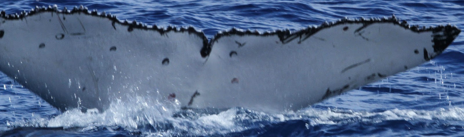
To give you an idea as to what some of the follow-up science involves, I've quickly put together the below fluke images. The image on the top is the dorsal surface of a whale's fluke and the image in the middle is a 'magnetic lasso' trace of the same fluke's edge. Although these top two images do not capture the ventral surface coloration pattern, the shape of the serrated edge of the fluke potentially be used to help confirm a re-sighting of this whale sometime in the future. The bottom image is of the ventral surface of a different whale's fluke - notice the difference in serration and the patterned colorations? These are some of the key features we use to ID whales.


Top - Dorsal (back) surface of one whale's fluke; Middle - A computer generated trace of the fluke above; Bottom - Ventral (bottom) surface of a different whale's fluke.

One of the key steps in any scientific research process is to document what you've observed. The fluke and dorsal fin photos will be compiled in a database and ultimately made available to the wider humpback whale community for possible matching between different years and/or different places.

Here's hoping we have another successful day tomorrow and my fingers are crossed for some Argos location data in the morning!

Thanks for following along, folks. We're well and truly into the journey...

- Travis Horton

Thursday, 28 August 2014

Media Coverage

The Rarotonga 2014 Humpback Whale satellite tagging team is grateful to all the media exposure we've been getting over the past few days!

 For those interested, here are some links:

Cook Islands News (newspaper)

Cook Islands Television (11 minute video)

60 Minutes (U.S.A. - replay on August 14, 2014 of Oct. 2013 interview with Nan Hauser)

NewsTalk ZB has a small piece on our research on-line and the U.S. Embassy in New Zealand has released a press release.

More information is always available (Thanks to the great work of Byron Brown, one Nan's core team members!) at www.nanhauser.com.

Off to the water!  Happy Birthday Madeleine!!  Daddy loves you so much kiddo!!

-Travis Horton